 Germany
 History: Antique Maps
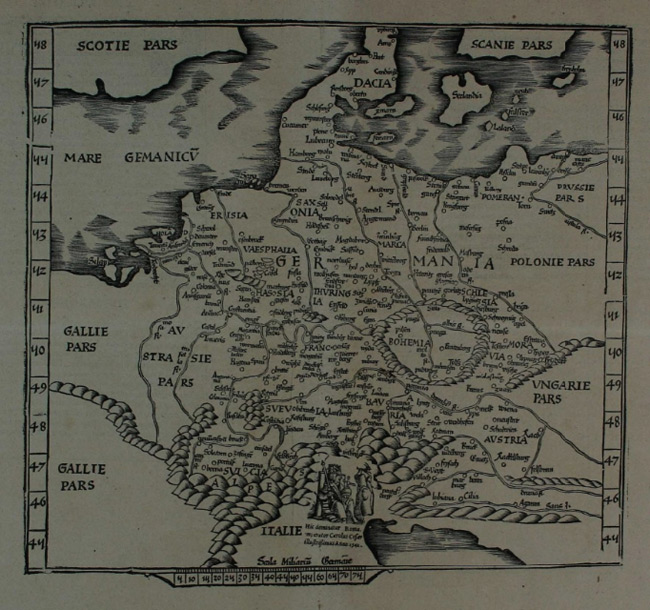
- Title: 1541 Map of Germany
- Description: Germany. Early black and white woodcut after Ptolemy.
- Publisher: Martin Waldseemuller
- Download: High-Res pdf
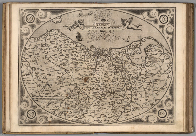
- Title: 1570 Map of (14) Germaniae Inferioris
- Publisher: Gielis Coppens van Diest
- Download: High-Res pdf
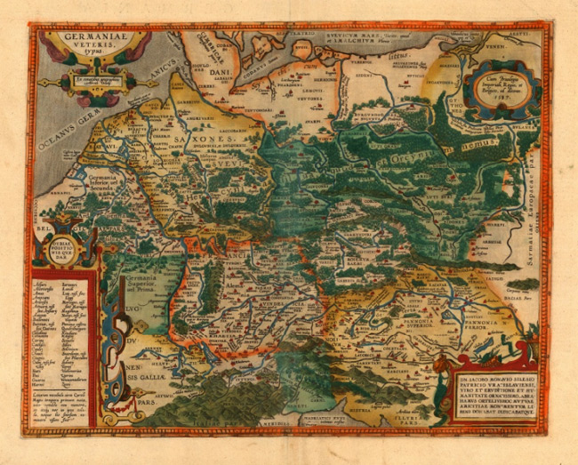
- Title: 1592 Map of Germaniae Veteris Typus
- Description: Beautiful map of ancient Germany signed by Ortelius himself and dedicated to Jakob Monau. Original colour.
- Publisher: Abraham Ortelius
- Download: High-Res pdf
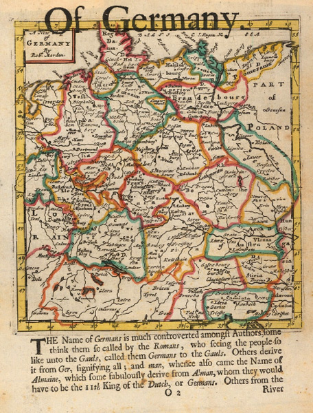
- Title: 1688 Map Of Germany
- Description: Pleasantly small English rendition of Germany by Robert Morden set above a 17th century description of the country. Coloured.
- Publisher: Robert Morden
- Download: High-Res pdf
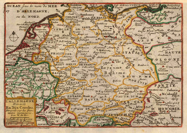
- Title: 1705 Map of Allemagne divisee en Dix Cercles
- Description: Early French map of Germany divided into its regions or \"circles\". Coloured.
- Publisher: Nicolas De Fer
- Download: High-Res pdf
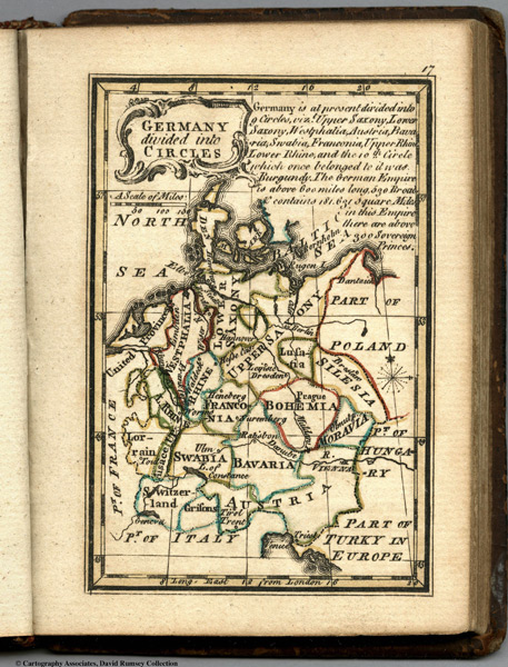
- Title: 1758 Map of Germany Divided Into Circles
- Description: This page includes Outline color map of the world and text. First edition. The \"Historical Extracts\" are short bits of text printed on the maps giving relevant geographical information.
- Publisher: J. Newberry
- Download: High-Res pdf
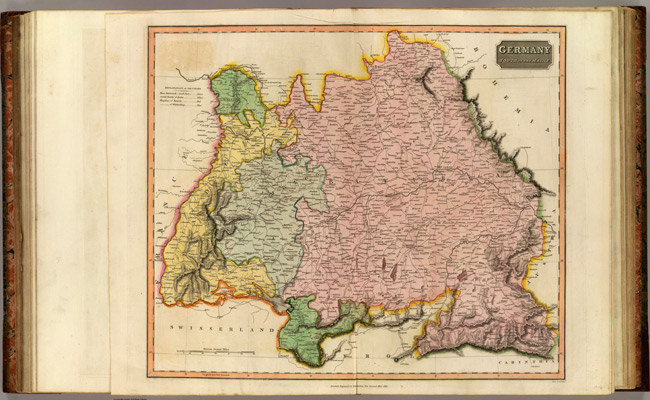
- Title: 1816 Map of Germany S. of Mayne
- Description: Engraved map. Hand colored. Relief shown by hachures. Includes Vorarlberg and the Archbishopric of Salzburg.
- Publisher: Baldwin, Cradock, and Joy
- Download: High-Res pdf
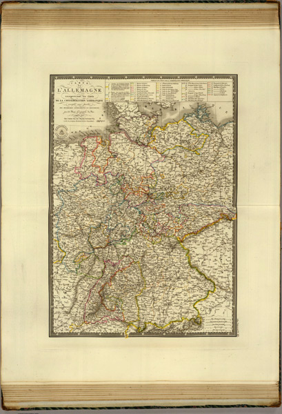
- Title: 1827 Map of Allemagne
- Description: Hand colored engraved map. Relief shown by hachures.
- Publisher: A. Brue
- Download: High-Res pdf
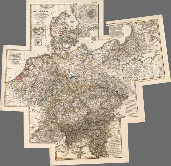
- Title: 1850 Map of Composite: Deutschland
- Description: Composite of five maps of parts of Germany.
- Publisher: Justus Perthes
- Download: High-Res pdf
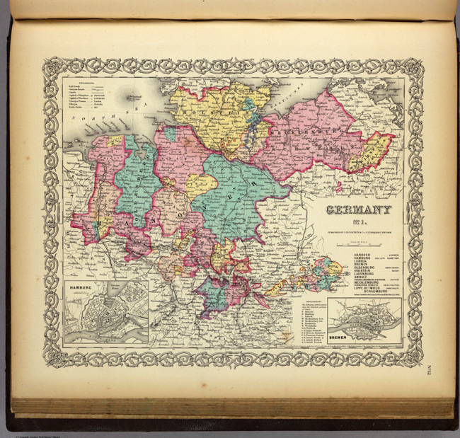
- Title: 1856 Map of Germany No. 1
- Description: In full color by region. A key to the abbreviations showing the detached portions of the States is included. Northern Germany is shown. Political divisions are referenced to the side of the map (i.e. Kingdom, Duchy, Principalities).
- Publisher: J.H. Colton
- Download: High-Res pdf
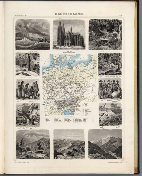
- Title: 1863 Map of Deutschland
- Description: Lavishly illustrated around margins of map with high quality vignettes of animals, structures and people. Relief shown in hachures.
- Publisher: F.A. Brockhaus
- Download: High-Res pdf
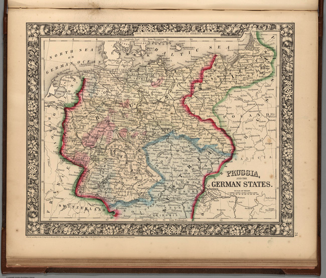
- Title: 1865 Map of Prussia, and the German States
- Description: Full color map by political divisions. Note: \"All within the Red Boundary belongs to the Germanic Confederation\". Relief shown by hachures.
- Publisher: S.A. Mitchell Jr.
- Download: High-Res pdf
Copyright © 1993—2025 World Trade Press. All rights reserved.